Town
Where to Stay in Mount Washington
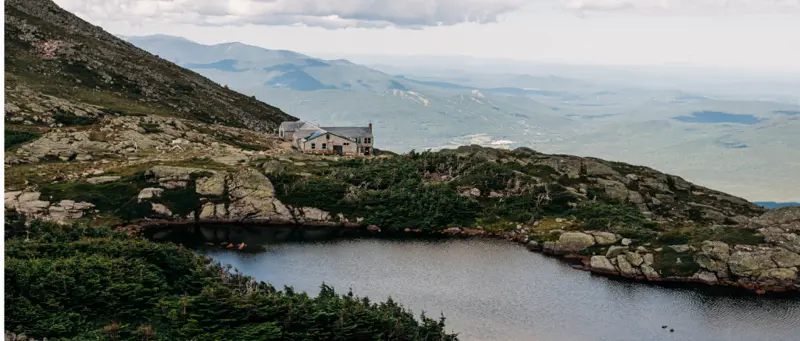
The summit of Mount Washington, at 6,288 feet, is the highest point in the northeastern United States, and its weather is notoriously severe. The Mount Washington Observatory, staffed continuously since 1932, has recorded winds above 100 mph in every month of the year, and the 231 mph gust it measured in 1934 remains the record for the Northern and Western Hemispheres. The weather above treeline can turn dangerous quickly, in any season. The AMC's Lakes of the Clouds Hut sits at 5,012 feet, below the summit cone, beside two small alpine lakes between Mount Washington and Mount Monroe. It is the highest and largest of the AMC's huts, sleeping 90 in bunk rooms, with dinner and breakfast included. It is open from early June to mid-September, and summer weekends book up well ahead.
Why Stay in Mount Washington
- •The hut sits above treeline on the Crawford Path, between the summit of Mount Washington and the Southern Presidentials.
- •From the hut, the summit and back, or a Southern Presidential traverse over Monroe, Eisenhower and Pierce, can be split over two days.
- •The hut sits just below Mount Monroe, beside the two Lakes of the Clouds.
- •Dinner and breakfast are included, cooked by the hut crew.
What Makes This Area Interesting
- •Mount Washington summit: about 1.5 miles above the hut via the Crawford Path, with the observatory, a museum and, on busy days, crowds from the Auto Road and Cog Railway.
- •Tuckerman Ravine: the classic eastern approach to the summit, accessed from Pinkham Notch; famous for late-season skiing (skiers hike in April and May).
- •The Southern Presidential Traverse: Monroe, Eisenhower, and Pierce are accessible from the hut, all above or near treeline.
- •Mount Washington Auto Road: the other way up, accessible from Route 16 in Pinkham Notch between May and October.
Explore Nearby Towns
Frequently Asked